SUE Subsurface Utility Engineering
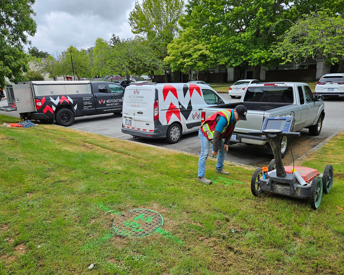
Westcoast Scanning Ltd. is a leading provider of complete utilities locating services. We use the latest in technology to ensure the best possible data is collected in the most efficient and safe manner. Trust us to deliver reliable results through SUE methodology to keep your informed, on track and on budget.


Geophysical Survey Systems: A normal polarization profile (left) and a cross-polarization profile (right) collected across the same transect.
Key Technology
Ground-Penetrating Radar (GPR)
GPR investigations are an essential part of any locating project. Our well-trained and field-experienced technicians expertly collect, analyze, and interpret the sub surface’s composition and any infrastructure elements. We can accurately establish the location, direction, and depths of utilities as well as voids, water table and other soils layers through contrasting dielectric properties.
Industries Served
- Construction
- Structural Development
- Building Maintenance and Restoration
- Transportation
- Petrochemical and Energy
Key Features of SUE
We use the latest in technology to ensure the best possible data is collected in the most efficient and safe manner.
Radio Frequency Locating (RF) and A-frame Fault Locator
We employ RF detection technology to induce frequencies to conductive utilities/embeds. 4-way sweeps are also very helpful when conducting a thorough locate. The A-frame is used to locate ground faults in direct buried insulated wire.
Electromagnetic Locators (EM)
These devices help us locate buried metallic utilities by detecting the electromagnetic fields they emit. By analyzing the signal strength and direction, we can very precisely mark the entity’s position for mapping or excavating purposes.
GIS and GPS Integration
Our utilities locate services seamlessly integrate with Geographic Information Systems (GIS) and Global Positioning System (GPS) technologies. This enables precise mapping, data management, and easy collaboration with other project stakeholders.
Drone Imaging Integration
Our licensed drone pilots take high-resolution wide-angle aerial pictures which we incorporate into our reports. This helps engineers and providers map utility grids, troubleshoot problems, and plan new utility layouts. Stay tuned for exciting new technology which incorporates GPR air sensors.