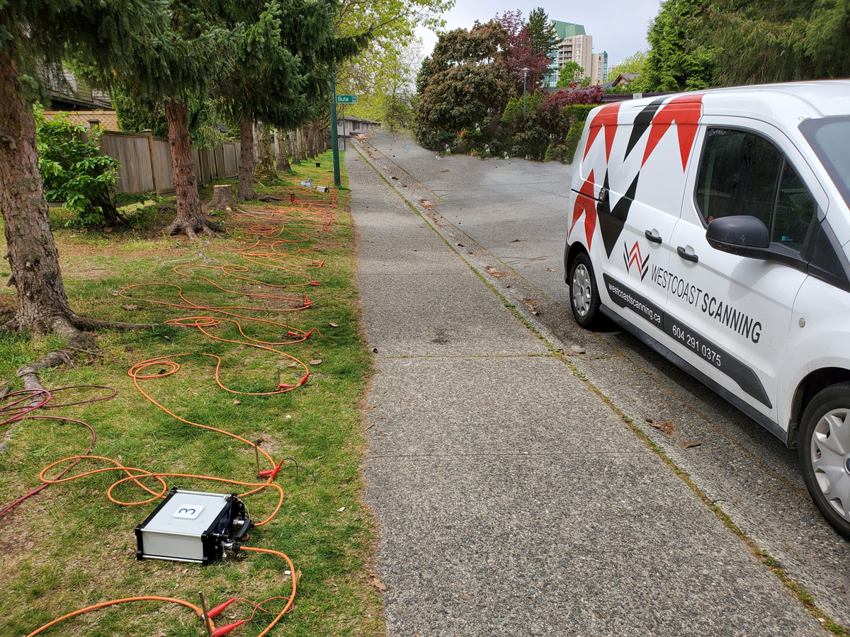
ERT Electrical Resistivity Tomography
ERT is an innovative method of image the subsurface, allowing engineers to visualize the distribution and variations of subsurface materials. This helps in understanding the geological structures, identifying anomalies, and mapping different soil and rock layers

ERT Advantages
Subsurface Imaging in 3D
ERT is an innovative method of image the subsurface, allowing engineers to visualize the distribution and variations of subsurface materials. This helps in understanding the geological structures, identifying anomalies, and mapping different soil and rock layers.
Non-Destructive
ERT is a non-destructive testing technique, it does not require invasive drilling or excavation, which is particularly advantageous when working in sensitive or congested areas requiring minimal disturbances.
Cost-effective
ERT is generally more cost-effective than other geotechnical techniques such as drilling and sampling because it reduces the need for extensive drilling and excavation.
High Resolution
ERT can provide high-resolution images of the subsurface, allowing engineers to identify small-scale features such as fractures, voids, and weak zones. This level of detail is beneficial for understanding the potential risks associated.
Time Efficiency
It doesn’t require excavation or drilling to gather subsurface information. ERT can be conducted relatively quickly, and the results can be obtained in near or real-time.This allows immediate feedback on changes.
Versatility
ERT can be used in geological settings and applications in geotechnical engineering, such as slope stability assessments, foundation design, groundwater studies, contaminant plume mapping, etc.
Data Integration
ERT enhances geotechnical and environmental data, such as borehole logs, groundwater sampling, and laboratory test results. Which facilitates engineering designs, and greatly assists the decision-making process.
ERT Applications
Environmental Engineering
Contaminant Plume Delineation
ERT maps variations in the subsurface to delineate contaminant plumes. Our system reveals the extent, boundaries, and behavior of contaminant plumes, which is essential for remediation planning.
Landfill Monitoring
ERT monitors landfill sites. It characterizes waste layers, leachate migration, and containment systems. ERT monitoring detects electrical resistivity changes over time, revealing contaminant movement.
Monitoring Remediation Efforts
Regularly repeated ERT surveys track electrical resistivity changes, revealing contaminant movement and attenuation. This real-time monitoring enables remediation strategy adjustments and optimizing efficiency.
Hydrogeological Investigations
ERT considers subsurface hydrogeological properties, such as groundwater flow, aquifer characterization, and water content. It maps electrical resistivity variations, identifying flow paths, water-bearing zones, and groundwater barriers. This critical data supports sustainable water management, groundwater extraction and recharge systems.
Environmental Impact Assessments
ERT shows the subsurface impacts of development projects. It illustrates vulnerabilities created from construction activities, such as groundwater flow alterations, contamination, and instability. ERT data greatly assists and facilitates decision-making and mitigation planning.
Geotechnical Stability Assessments
ERT maps electrical resistivity differences in the subsurface to evaluate slopes, embankments, and other structures in environmental projects. It detects weak zones, moisture changes, and failure risks. This helps design stabilization and mitigation measures.

Digital X-Ray Imaging Solutions
Unlocking the Power of Precision, Efficiency and Safety
At Westcoast Scanning Ltd., we combine cutting-edge x-ray generators with high-resolution digital imaging to identify structural defects and embedments with 100% accuracy through construction and organic materials.
Industries Served
- Construction
- Structural Development
- Building Maintenance and Restoration
- Transportation
- Petrochemical and Energy
ERT Application in Geo-Technical Engineering
Don’t compromise when it comes to concrete scanning. Choose the experts who deliver the best results. Contact Westcoast Scanning today for a consultation and discover the future of concrete inspection.
Soil and Rock Layer Mapping
ERT maps soil and rock layers. It measures the electrical resistivity of materials, identifies boundaries/variations, and layer thickness. This information is critical for understanding the subsurface profile which affects the foundation and excavation design.
Slope Stability Assessments
ERT assesses slope and embankment stability. It maps variations in the subsurface and identifies failure mechanisms, such as shear zones, water changes, or weak layers. ERT data helps understand the slope structure and greatly assists in comprehensive design stabilization measures to improve slope stability.
Groundwater Studies
ERT identifies groundwater depth, water-bearing zones and aquifers. It measures changes providing insights into subsurface water content variations which are crucial for excavation, dewatering, and groundwater management for pre- and post-construction purposes.
Void Detection
ERT detects and maps subsurface voids, cavities, and underground openings which can threaten infrastructure stability. This data is critical when assessing underground structure integrity such as tunnels, mines, foundations, and for planning remediation measures.
Tunnelling and Underground Construction
ERT illustrates current subsurface conditions and helps to analyze risks in tunneling and underground projects. It identifies geological structures, rock or soil quality, and hazards like water inflows or weak zones. ERT data helps in planning and designing tunneling projects, optimizing construction methods, and ensuring underground structure stability and safety.
Grout Injection Monitoring
Grout injection is a technique for soil stabilization, foundation underpinning, and ground improvement. ERT real-time monitoring provides information about grout distribution. ERT can be employed for monitoring pre- and post-injection assessment, injection design & planning, quality control.